Fumarole Bay Trail on Wizard Island
Trail Statistics and Features Explanations | |
| TT Score (x/100) | |
| TT Rank in Park (5/10/No) | 10 |
Trail Length (mile one way) | 0.8 |
Total Ascent (feet one way) | 156 |
Total Descent (feet one way) | 163 |
| Highest Elevation (feet) | 6,278 |
| Lowest Elevation (feet) | 6,188 |
| Average Grade (%) | 3.72 |
| Maximum Grade (Degree) | 23 |
| Dogs Allowed? | No |
| Solitude Score (x/10) | 7/We |
Creek/River/Lake? | Lake |
| Special Feature | Lake |
| Video Link | |
| Photo Gallery Link | |
| USGS Map | Download |
| Difficulty Rating | Easy |
| Type of Hiker | Prefers Solitude |
| Terrain | Very Rocky |
| Craziness Score | Low |
| Captures Essence of Park | Yes |
| Unique Experience in Park | Yes |
| Season | Boat Schedule |
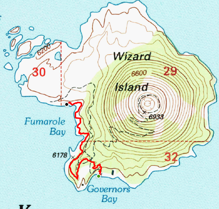
The trail is shown on the two maps below. The first is an interactive OpenStreetMap and the second is a USGS topo map. OpenStreetMaps are licensed under the Open Data Commons Open Database License by the OpenStreetMap Foundation. US topo maps can be reproduced freely and they are provided courtesy of the U.S. Geological Survey.


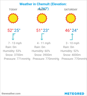
The image above shows the current 3-day weather in Chemult, one of the closest towns to Crater Lake, NP. Weather depends on elevation. Chemult is at 4,767 feet elevation. Legend "Snow" indicates the elevation height for the current snowline. As usual, everything is for general information purposes only. Best source of information are local park officials.
Crater Lake National Park's Alert and Current Conditions Page is shown below. Terrific Trails has no affiliation with the National Park Service. Information on the NPS website is public domain, consequently you are free to distribute the NPS sourced material. No protection is claimed in original U.S. Government works. See details on the NPS website.